Archives: Services

Overview

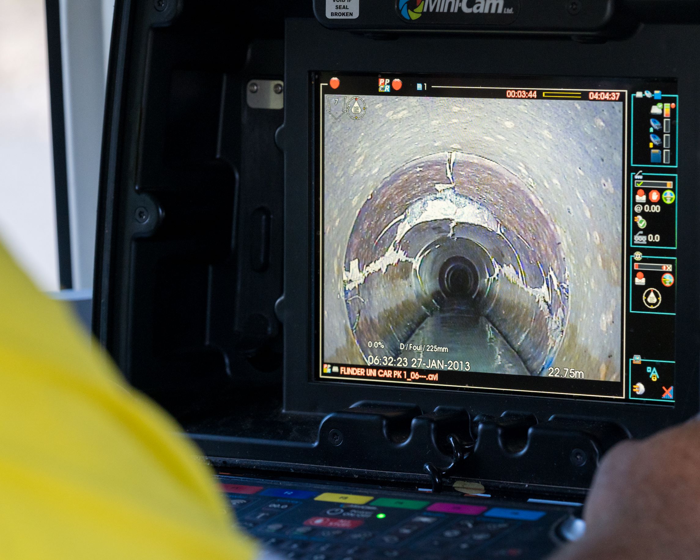
Pipe inspection using a camera is a process of using a specialized sewer pipe inspection camera connected to a flexible cable to see inside of pipelines, sewer lines, and other pipes. The purpose of this is to identify the source of blockages or backups and any problems with the pipe such as root intrusion, cracks, punctures, corrosion, etc.

Project Planning

Create a customized plan that meets customers unique needs and specifications.

satisfied Service

Establish and maintain ongoing communication with the customer to ensure personalized and attentive service

Dedicated Team

A dedicated and professional team dedicated to delivering exceptional service to you

Benefits of Service

Pipe inspection using a camera, also known as CCTV (closed-circuit television) pipe inspection, is a method of inspecting the interior of pipes, sewers, and drain lines to detect any damage or blockages. This method is commonly used in the maintenance and repair of drainage systems, plumbing systems, and other underground infrastructure.

The process typically involves inserting a small camera, mounted on a flexible rod, into the pipe. The camera is connected to a monitor or recording device that allows the operator to view the inside of the pipe in real-time. The camera is equipped with a light source to illuminate the pipe, making it possible to see any cracks, blockages, or other damage that may be present.

The camera is usually moved through the pipe using a winch or push rod, allowing the operator to inspect the entire length of the pipe. Some cameras also have pan and tilt functions which help the operator to take images from different angles of the interior of the pipe.

The inspection results are recorded and can be saved for future reference. The footage can be used to create a detailed report of the condition of the pipe, including the location, size, and severity of any damage or blockages. This information can then be used to plan repairs or maintenance work.

CCTV pipe inspection can be done for various types of pipes such as, PVC, Cast Iron, Steel, AC and Concrete. The choice of camera and method of inspection will depend on the type of pipe and the condition of the pipe.

Overview

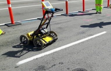
Locating by georadar, also known as Ground Penetrating Radar (GPR), is a tool used to locate underground structures and objects without causing any damage. It can be used to detect utilities such as pipes and cables, and is often employed in surveying teams to locate subsurface utilities.

Project Planning

Create a customized plan that meets customers unique needs and specifications.

satisfied Service

Establish and maintain ongoing communication with the customer to ensure personalized and attentive service

Dedicated Team

A dedicated and professional team dedicated to delivering exceptional service to you

Benefits of Service

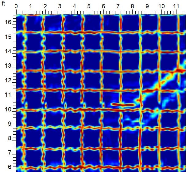
Ground Penetrating Radar (GPR) is used to identify subsurface features and characteristics without the need for excavation. The process involves emitting a radio frequency signal into the ground and measuring the reflections that return to the surface. The reflection data is then used to create a cross-sectional image of the subsurface.

There are several reasons why GPR is a preferred method for utility positioning compared to other methods:

Non-destructive: GPR is a non-destructive method, meaning it does not require excavation or drilling to locate subsurface features. This is particularly useful for identifying utilities in densely populated areas, where excavation can be disruptive and costly.

High accuracy: GPR can achieve high levels of accuracy in identifying subsurface features, especially when combined with other survey methods such as electromagnetic location. This can help to locate buried utilities with a high degree of precision.

Versatility: GPR can be used to locate a wide range of subsurface features, such as metal, plastic, and concrete pipes, as well as other types of underground infrastructure. It can also be used to locate subsurface features in a variety of soil types and ground conditions.

Real-time data: GPR can provide real-time data, which can be used to quickly identify the position and depth of subsurface features. This can save time and money compared to other methods, which may require multiple visits to the survey site.

Cost-effective: GPR is a cost-effective method, as it requires less labor and equipment than other methods such as excavation. It also eliminates the need to repair the ground surface after the survey, thus reducing the total cost of the survey.

Overview

Pipe inspection using a camera is a process of using a specialized sewer pipe inspection camera connected to a flexible cable to see inside of pipelines, sewer lines, and other pipes. The purpose of this is to identify the source of blockages or backups and any problems with the pipe such as root intrusion, cracks, punctures, corrosion, etc.

Project Planning

Create a customized plan that meets customers unique needs and specifications.

satisfied Service

Establish and maintain ongoing communication with the customer to ensure personalized and attentive service

Dedicated Team

A dedicated and professional team dedicated to delivering exceptional service to you

Benefits of Service

Knowing the location of an oil tank is important for a number of reasons:

Safety: If an oil tank is leaking, it can pose a serious safety hazard to the environment and nearby residents. Knowing the location of the tank can help prevent leaks and spills, and ensure that any leaks or spills that do occur are quickly contained and cleaned up.

Environmental protection: Oil leaks and spills can cause significant environmental damage, including contamination of soil and water. Knowing the location of the tank can help prevent these types of incidents, or minimize their impact if they do occur.

Property value: Knowing the location of an oil tank can affect the value of a property, especially if the tank is found to be leaking or otherwise in poor condition. This information can be important for buyers and sellers of properties that may have underground oil tanks.

Compliance with regulations: Many local and state governments have regulations regarding the installation, maintenance, and removal of underground oil tanks. Knowing the location of a tank is necessary to comply with these regulations and avoid potential fines.

Cost savings: Knowing the location of an oil tank can help avoid costly mistakes, such as accidentally digging through or damaging the tank during construction or landscaping projects.

Underground oil tank location can be done by using a variety of underground surveying methods. The most common methods include:

Ground-penetrating radar (GPR): GPR uses radar waves to penetrate the ground and create a detailed image of the subsurface. This method can be used to locate underground oil tanks by detecting changes in soil density caused by the tank.

Electromagnetic locators: Electromagnetic locators use electromagnetic waves to locate metallic objects, such as underground oil tanks, by detecting changes in the electromagnetic field caused by the metal.

Overview

Concrete scanning is the use of ground penetrating radar and other equipment to detect materials or voids within a concrete slab. It is used to inspect concrete slabs or columns before coring or drilling in renovations and new construction projects. It is similar to an x-ray of a human body, using radar to get an inside look at even large slabs of concrete. Concrete scanning is also crucial for analyzing the contents of a concrete structure, including the thickness of the concrete itself as well as any other objects that may be embedded in it.

Project Planning

Create a customized plan that meets customers unique needs and specifications.

satisfied Service

Establish and maintain ongoing communication with the customer to ensure personalized and attentive service

Dedicated Team

A dedicated and professional team dedicated to delivering exceptional service to you

Benefits of Service

A concrete scan in land and underground surveying is the process of using specialized equipment to create a detailed image of the interior of a concrete structure.

This type of scan is typically done using Ground-Penetrating Radar (GPR) equipment. GPR sends electromagnetic waves into the concrete and measures the reflection to create a detailed image of the subsurface features

Concrete scans are commonly used in construction and engineering projects, such as new building construction, renovations, and remodels, as well as in infrastructure projects like bridges and roads. They are used to locate and map potential issues such as reinforcing steel, post-tension cables, conduit, voids, and other objects that may be embedded in the concrete, which could affect the structural integrity of the building or infrastructure.

Project Overview

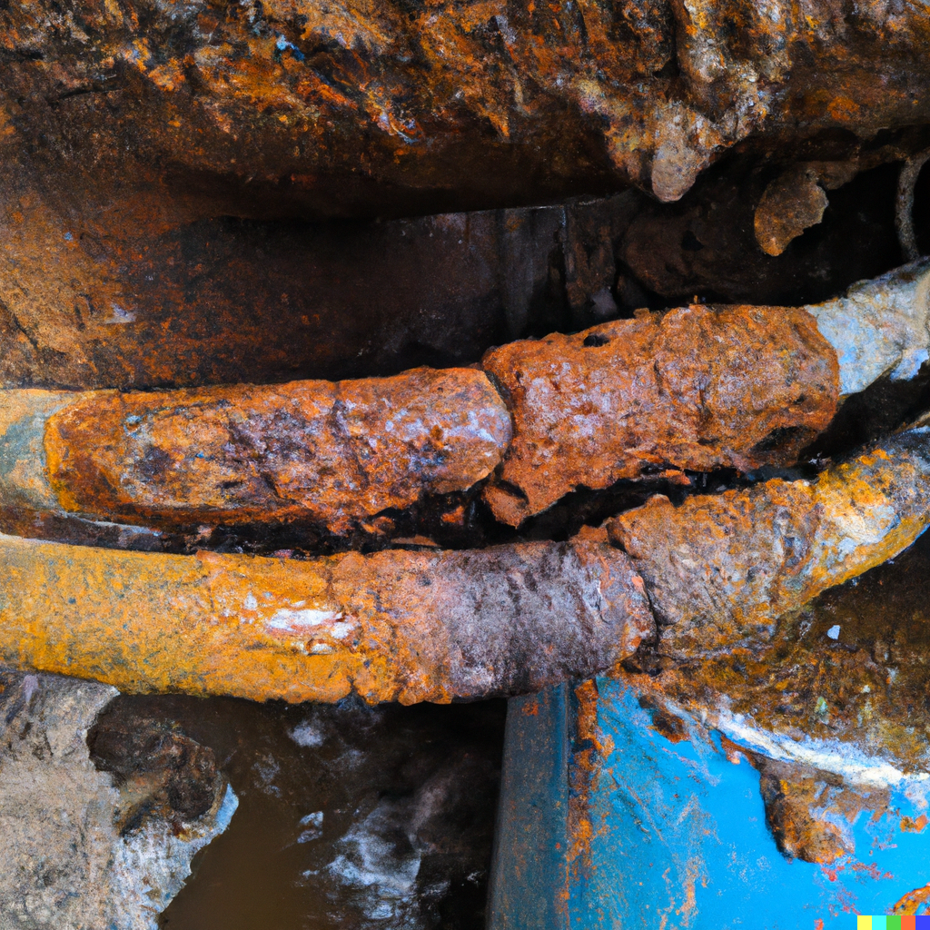
A process of identifying and pinpointing the presence of rust and corrosion in underground cables using surveying techniques. This might involve using specialized equipment to scan for signs of corrosion. Surveying the cables can also include visual inspections, taking measurements and collecting data that can help to identify the extent and severity of the corrosion, which is important for maintaining the integrity of the cables and ensuring the safety of the infrastructure.

Project Planning

Create a customized plan that meets customers unique needs and specifications.

satisfied Service

Establish and maintain ongoing communication with the customer to ensure personalized and attentive service

Dedicated Team

A dedicated and professional team dedicated to delivering exceptional service to you

Benefits of Service

Our specialist can detect several types of defects in underground cables, including:

Corrosion: GPR can detect corrosion on metal cables, both on the outer surface and inside the cable.

Cracks: GPR can detect cracks and breaks in underground cables, which can cause loss of power or signal transmission.

Water infiltration: GPR can detect water infiltration inside underground cables, which can cause damage to the cable insulation and lead to short-circuiting.

Splices and connections: GPR can detect splices and connections in underground cables, which can indicate a potential point of failure.

Cable depth: GPR can also detect the depth of underground cables, which can be useful in determining the location of the cable and avoiding damage during excavation or construction.

Cable damage: GPR can also detect damage to the cable insulation and the metal conductor inside the cable.

When GPR is used to detect corrosion in underground cables, the electromagnetic wave is able to penetrate the cable and reflect back to the surface. The reflection will be different if the cable is corroded or not. Corroded cables will reflect a weaker signal back to the surface than a non-corroded cable.

When GPR is used to detect cracks, breaks, water infiltration, splices and connections and cable depth, the GPR will detect the change in the subsurface composition, and will reflect different signals, the operator can then interpret this data to locate the specific defects.

Overview

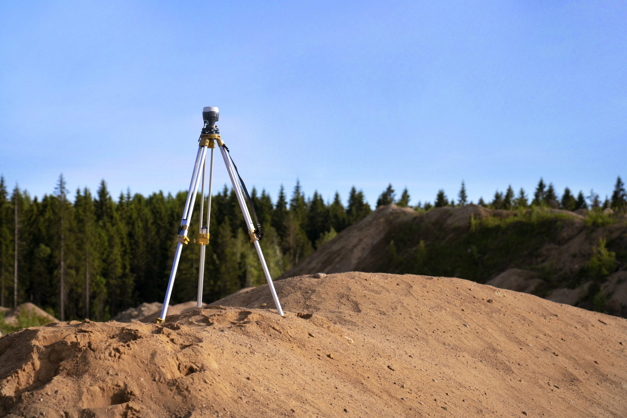
Survey by geopositioning is a method of mapping and modeling the physical world using GPS (Global Positioning System) technology. It uses signals from satellites to pinpoint a location on the Earth’s surface and can provide surveying and mapping data of high accuracy. GPS-based data collection is much faster than traditional surveying methods.

Project Planning

Create a customized plan that meets customers unique needs and specifications.

satisfied Service

Establish and maintain ongoing communication with the customer to ensure personalized and attentive service

Dedicated Team

A dedicated and professional team dedicated to delivering exceptional service to you

Benefits of Service

One of the main advantages of GPS survey is its high level of accuracy. GPS surveying can achieve sub-meter and even centimeter-level accuracy, depending on the type of GPS system used and the correction methods applied. This level of accuracy is much higher than traditional surveying methods, such as total stations or traditional ground-based methods, which can only achieve accuracy in the range of a few centimeters to decimeters.

Additionally, GPS surveying allows for the collection of data in real-time, which eliminates the need for multiple visits to the survey site. It also allows for the collection of data in remote or hard-to-access areas. This can save time and money compared to traditional methods. It also allows for the integration of data from multiple sources, such as satellite imagery, aerial photographs, and field measurements. This can provide a more complete picture of the survey area.


Overview

Electromagnetic locating is a method used to detect the electromagnetic signals radiating from metallic pipes and cables buried deep underground. This is done by detecting the magnetic field around a utility system produced by a radio frequency. Electromagnetic induction tools are used to locate a wide range of underground assets, including fibre optics, and the science behind it is based on the principle that a current flowing along a conductor creates a magnetic field.

Project Planning

Create a customized plan that meets customers unique needs and specifications.

satisfied Service

Establish and maintain ongoing communication with the customer to ensure personalized and attentive service

Dedicated Team

A dedicated and professional team dedicated to delivering exceptional service to you

Benefits of Service

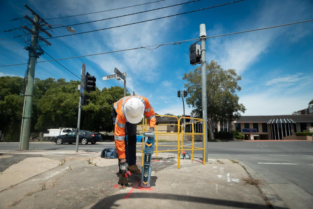
It uses electromagnetic fields to locate and identify underground utilities such as pipes and cables. It works by transmitting an electromagnetic signal into the ground using a transmitter, which induces a secondary signal in any conductive objects that are present underground. This secondary signal is then detected by a receiver and used to locate the underground utilities.

There are several advantages to using electromagnetic locating in underground surveying as compared to radar:

Non-destructive: Electromagnetic locating does not involve physically digging or excavating, making it a non-destructive method of locating underground utilities.

Can locate deep utilities: Electromagnetic locating can locate utilities that are deeper than most other locating methods and can reach up to 20 meters deep, whereas radar is limited to a depth of around 10 meters.

More accurate in some cases: Electromagnetic locating is more accurate in locating metal pipes and cables and can provide more precise location information for underground utilities, especially in case of buried metal pipes and cables.

Can be used in conjunction with other methods: Electromagnetic locating can be used in conjunction with other methods, such as ground penetrating radar (GPR) or pipe and cable locators, to provide a more complete picture of the subsurface.

Cost-effective: Electromagnetic locating is often a cost-effective option when compared to other locating methods, such as excavation or ground-penetrating radar.

However, it’s worth noting that radar has its own advantages as well, like its ability to detect subsurface voids, and map the subsurface structure, and to detect utilities that are not conductive, making it a good complementary method to Electromagnetic locating.

The complete process of Electromagnetic Locating typically includes the following steps:

Site preparation: The survey area is prepared by identifying the location of the underground utilities that need to be located and marking the area to be surveyed.

Ground conductivity testing: The ground conductivity is tested to determine the best method and equipment for the survey.

Equipment setup: The electromagnetic locating equipment is set up and calibrated, including the transmitter and receiver.

Signal injection: The transmitter is used to inject an electromagnetic signal into the ground, which induces a secondary signal in any conductive objects, such as metal pipes or cables, that are present underground.

Signal detection: The receiver is used to detect the secondary signal, which is used to locate the underground utilities.

Data collection: The data collected is analyzed and recorded, including the location, depth, and direction of the underground utilities.

Reporting: The data is analyzed and a report is prepared, including the location, depth, and direction of the underground utilities.

Follow-up action: Based on the findings, follow-up actions are taken such as marking the location of the underground utilities, and providing the client with the necessary information to plan their construction activities accordingly.

Overview

Structural assessment is a procedure used to evaluate the adequacy, structural integrity and soundness of structures and their components. It is performed to ensure that structures meet all applicable building codes related to structural integrity and can be conducted in response to a major structural or functional deficiency detected during an inspection. During a structural assessment, engineers visit the property and observe, note and discuss particular structural items.

Project Planning

Create a customized plan that meets customers unique needs and specifications.

satisfied Service

Establish and maintain ongoing communication with the customer to ensure personalized and attentive service

Dedicated Team

A dedicated and professional team dedicated to delivering exceptional service to you

Benefits of Service

It is to determine the strength, stability and safety of underground structures such as tunnels, mines, and underground buildings. This includes assessing the ability of these structures to withstand loads and forces such as soil pressure, rock stress, and ground movement. The analysis also considers factors such as the geology of the site, the materials used in construction, and the design of the structure. The outcome of the analysis is used to determine if the structure is safe for use and if any modifications or repairs are needed to ensure its long-term stability and safety.

Structural analysis in underground typically includes several key components. Based on the results of the analysis, recommendations for maintenance and repairs may be made to ensure the long-term stability and safety of the structure.

Geotechnical analysis: This involves studying the properties of the soil and rock surrounding the underground structure, such as its strength, compressibility, and susceptibility to water infiltration. This is important to understand how the soil and rock will behave and affect the structure during construction and over time.

Stress analysis: This involves determining the distribution of stresses within the structure caused by external loads such as soil pressure and ground movement.

Deformation analysis: This looks at how the structure will move and change shape under different loads and boundary conditions.

Stability analysis: This evaluates the overall stability of the underground structure and its ability to resist collapse or failure.

There are several types of underground structures that can be analyzed structurally, including:

Tunnels: These are underground passageways used for transportation, such as road and rail tunnels, and pedestrian and service tunnels.

Mines: These are underground excavations used for extracting minerals and other resources.

Underground buildings: These are structures built entirely or partially below ground level, such as basements, underground garages, and underground stations.

Underground storage facilities: These are structures used for storage of resources such as liquid and gas storage tanks, nuclear waste disposal facilities and also underground power plants.

Shafts: These are vertical or inclined excavations used for ventilation, access, or transportation in mines and underground buildings.

Retaining walls: These are structures used to support soil or rock in underground excavations.

Underground water structures: These are structures designed to control and manage water resources, such as underground dams and reservoirs, underground canals and culverts.

The type of structure and the purpose it serves will determine the specific analysis methods used to evaluate its structural integrity, safety and stability.

Overview

Water leak detection is a method of identifying and locating leaks in water systems by listening for the sound that escaping water makes. This method uses specialized equipment, such as acoustic sensors and amplifiers, to amplify and detect the sound of leaking water. The acoustic sensors can be placed directly on the pipe or valve, or they can be placed on the surface above the pipe or valve, depending on the location and accessibility of the leak. This method is often used in underground pipes, where visual inspections are not possible or practical. It’s also used to detect leaks in industrial pipe lines, in oil and gas sector for detecting leaks in pipelines etc.

Project Planning

Create a customized plan that meets customers unique needs and specifications.

satisfied Service

Establish and maintain ongoing communication with the customer to ensure personalized and attentive service

Dedicated Team

A dedicated and professional team dedicated to delivering exceptional service to you

Benefits of Service

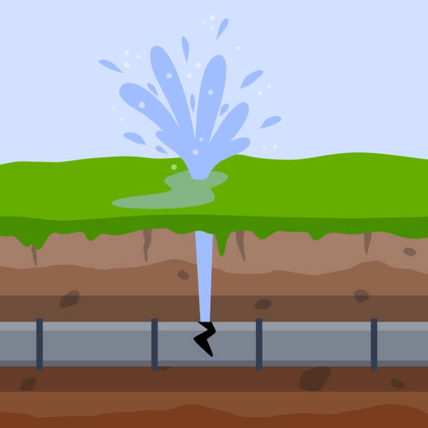
Water leak detection is the process of identifying and locating leaks in water pipes, irrigation systems, and other water-supply systems. There are two methods for detecting water leaks, including:

Acoustic Leak Detection: This method uses specialized listening devices to pick up the sound of water escaping from a pipe. The devices can be placed directly on the pipe or used in conjunction with a stethoscope to locate the source of the leak.

Correlation Leak Detection: This method uses specialized electronic devices that emit a high-frequency sound ad listen for the sound to return. The time it takes for the sound to return can be used to determine the location of the leak.

Overview

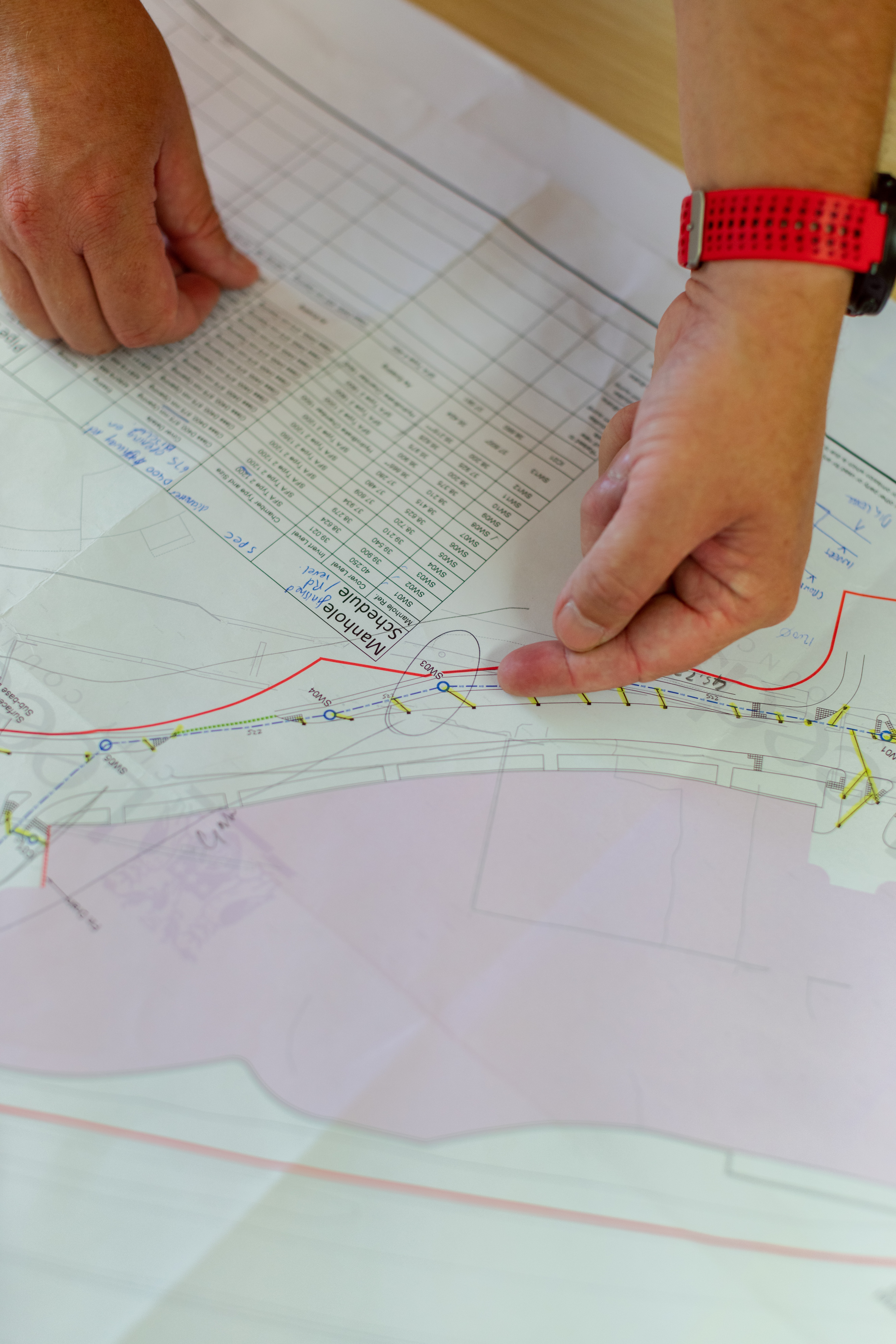
Utility locate is a process of surveying visible utility facilities such as manholes, valve boxes, etc. and correlating this information with existing utility records. Subsurface Utility Engineering (SUE) is a branch of engineering that involves the investigation of buried utilities and identifies potential conflicts between proposed construction and existing underground utilities. It also includes utility design and relocation services as well as comprehensive subsurface utility locating to find underground utilities like cable lines and gas lines.

Project Planning

Create a customized plan that meets customers unique needs and specifications.

satisfied Service

Establish and maintain ongoing communication with the customer to ensure personalized and attentive service

Dedicated Team

A dedicated and professional team dedicated to delivering exceptional service to you

Benefits of Service

Utility utility location engineering is the process of identifying and locating underground utility lines, such as gas, water, and electrical lines, using a variety of equipment and techniques. This can include ground-penetrating radar (GPR), subsurface imaging, and electromagnetic induction. The goal of utility location is to locate and map the position and depth of underground utilities so that they can be avoided during construction and excavation projects to prevent damage and maintain safety.

en_USEnglish
Whatsapp us